Despite being one of the fastest growing economies in the world, India faces a number of challenges due to a rapidly increasing population, changing dietary habits and degradation of natural resources. India is one of the most water-scarce countries in the world, a condition that is aggravated as climate change increases the frequency and severity of extreme weather events such as floods and droughts. It is expected that about half of the country’s water demand will not be met by 2030.
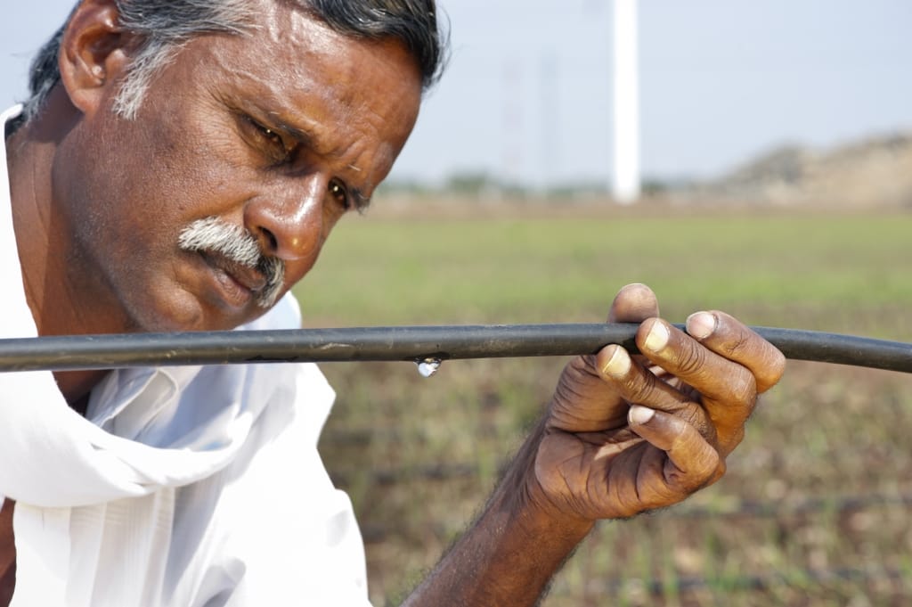
Agriculture employs about 50% of India’s workforce and most farmers are smallholders. Irrigation facilities are often poorly maintained, and only about half of the country’s cultivated area is irrigated. Cultivation of the remaining area is dependent on rainfall during the monsoon season, which is highly vulnerable to climate variability. India is increasingly reliant on groundwater, which supports over 60% of the irrigated area and much of the country’s drinking water needs. In parts of the country, overpumping of groundwater for agricultural use is resulting in a decline in the water table.
IWMI in India
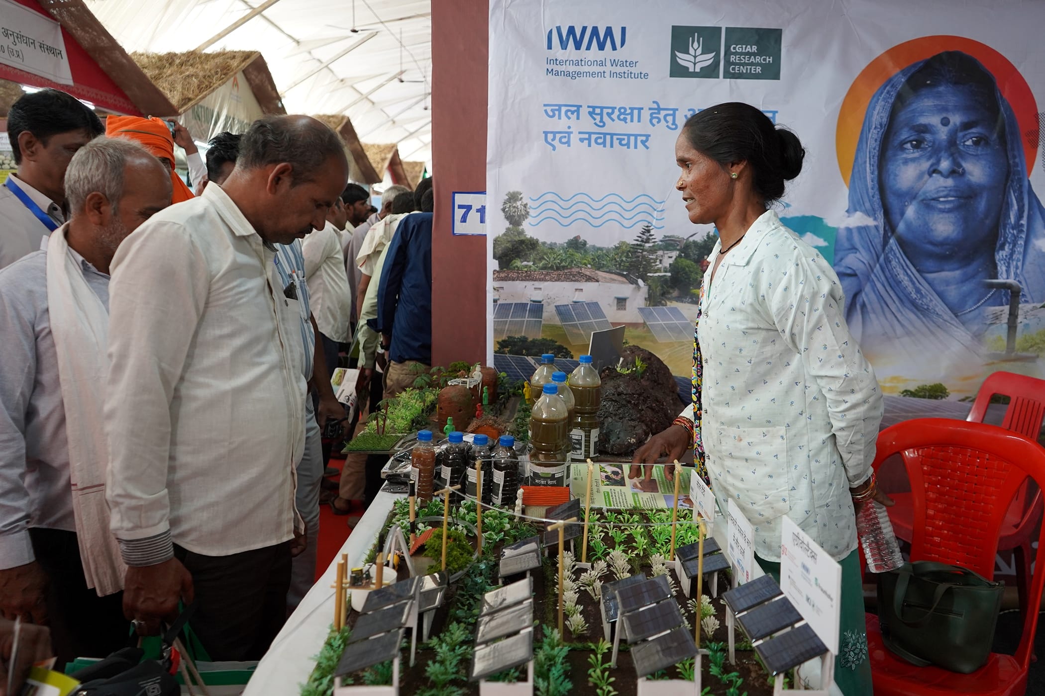
IWMI has carried out research on water and agriculture in India for over two decades. With offices in Delhi and Anand, where we are hosted by the Indian Council of Agricultural Research (ICAR), Department of Agricultural Research and Education (DARE), we work closely with ICAR, the government, research institutions, business and corporate social responsibility initiatives to help enhance the impacts of their water interventions. IWMI’s work in India focuses on enhancing water security and agricultural resilience through innovative solutions. A key area of work is integrating solar-powered irrigation systems to provide reliable water sources in water-scarce regions, boosting agricultural productivity and sustainability.
The IWMI-Tata Water Policy Research Program (ITP), launched in 2000, brings together IWMI and the Tata Trusts, a major philanthropic organization, to translate research findings into practical policy recommendations. Additionally, IWMI supports climate adaptation efforts, helping communities better withstand extreme weather events, while ensuring long-term water security through data-driven solutions like water accounting. These efforts aim to transform rural livelihoods and safeguard food production in a changing climate.
The recent launch of the CGIAR Climate Action Program in the Indian states of Odisha and Tamil Nadu marks a major step toward integrating science-based climate solutions into state-level planning …
The poor across the world is vulnerable to floods and drought disasters, which have a detrimental effect on the lives and livelihoods of the poor. Weather-based index insurance is one of the ways of dealing with these disasters. Protecting against floods and providing risk cover against losses due to floods has been a major area of concern for any government. Risk transfer through insurance is an important component in managing agricultural risks from extreme flood events. The study developed the first of its kind of design and implementation of an index-based flood insurance (IBFI) product with the advanced use of satellite data and flood models to estimate crop losses due to floods.
IBFI insurance product uses two different data elements, and the first one is based on the flood model using HEC-HMS and HEC-RAS that uses inputs from NASA GPM bias-corrected satellite rainfall estimates, observed water level and discharge data, river characteristics, and digital elevation model to generate flood depth and flood duration to develop predetermined thresholds based on the historical flood events between 1991 and 2015 and the second IBFI product uses only satellite data from NASA MODIS Terra and Aqua satellite data and the Copernicus Sentinel-1 SAR data to generate flood depth and flood duration to develop predetermined thresholds based on the historical flood events and economic losses. More than 7000 farming households in Bihar (India) and northern Bangladesh have signed up for a pilot IBFI scheme, which went live in 2017. The participating farmers have received insurance compensation for crop losses of over $US160,000. In addition to the insurance product implementation, the research evaluated the farming willingness to pay, developing business models for scaling, social equity, and economic benefits of derisk disasters.
IBFI initiative promotes a closer linkage between risk transfer and risk reduction that could make this a more sustainable and robust financial instrument for flood-affected communities and reduce the burden of postdisaster relief funds for the government. In summary, index insurance using open-access satellite imagery is a win-win opportunity as it brings down the data development cost, lower insurance premiums, quick settlement, and greater transparency among various users.
Case studies / Communities / Vulnerability / Risk transfer / Crop insurance / Rainfall / Remote sensing / Modelling / Flood forecasting / Weather index insurance Record No:H053138
Very few soil erosion studies have investigated the effectiveness of conservation tillage (CT)-based agrogeotextiles (AGTs) on rainfed sloping croplands of the Indian Himalayan Region (IHR) for intensifying unremunerative double cropping (maize-wheat) to sustainable remunerative triple cropping (maize-pea-wheat). This study assessed surface runoff, soil, and nutrient losses during the rainy season in maize crops to evaluate the impact of eight conservation practices on post-rainy season soil moisture content, productivity, and profitability of the crop rotation, and soil organic carbon (SOC) accumulation over a six-year period (2017–2023) on a 4% sloped natural runoff gauge plots (100 × 20 m2 ). The conservation practices involved a combination of rainfed maize-wheat and rainfed maize-pea-wheat crop rotations, utilizing two thicknesses (5 cm and 10 cm) and two configurations (0.5 m and 1.0 m vertical intervals) of Arundo donax (AD)-agro-geotextiles (AGTs), with comparisons drawn against the standard farmers’ practice of bench terraces (BT). In the treated CT fields, the highest amounts of residues (6.0–7.1 t ha- 1 ) were recycled by applying 5 and 10 cm thick AD-AGTs at a 0.5 m vertical interval (VI). Approximately 1100–1300 mm of rainfall per hectare per year was retained as soil water, and soil erosion decreased by 80–90% in the treated AD-AGT CT fields compared to the non-treated CT fields, which experienced a loss of 8.5 tonnes per hectare per year of soil. In the AD-AGT CT fields, the highest wheat equivalent yields (12.0–13.6 t ha- 1 year- 1 ), profits (2332–2477 US$ ha- 1 year- 1 ), and SOC build-up (1.16–1.20%) were recorded. In the treated fields, an average of 32–108 kg organic carbon, 3–6 kg nitrogen, 1–3 kg of phosphorus, and 8–37 kg potassium per hectare per year were retained, preventing their loss as pollutants through surface runoff water. The research provided scientific evidence indicating that triple cropping of maize-pea-wheat in a pure rainfed condition of IHR can be achieved without compromising wheat yields, provided that farmers apply CT-based AD-AGTs at the appropriate rate and configuration, i.e., emplacement of 5 cm thick biomass @ 1.1 t ha- 1 on a 0.5 m vertical interval. From a sustainable practice point of view, the study proposes a valorization for AD biomass that contains no economic value. Future soil and water conservation research should examine the impacts of AD-AGTs on soil and water conservation across a diverse range of rainfall and field slope conditions.
Arundo / Erosion / Soil water content / Wheat / Maize / Agricultural productivity / Conservation tillage Record No:H053878
The fast transition of India from a water-stressed to a water-scarce country has provided additional impetus for the search for interventions and decision support systems (DSSs) for solutions to problems arising from a mismatch between demand and supply and competing demands of economic and environmental sectors. Agriculture is the largest user of freshwater and increasing water productivity in agriculture is a national challenge requiring urgent attention. Globally, DSSs have gained immense popularity in various domains and, more recently, in agriculture and water resources management but are still limited in developing countries like India. This chapter presents a comprehensive compilation and stocktake of the DSSs developed at various scales in India and specific to the Ganges Basin, aimed at serving as a foundation for future work in this direction. After the criteria-based screening of the literature and reports, each selected DSS was analysed in the context of the aspects covered, key criteria, and the parameters such as relevance, applicability, focus, and scale of application. To reinforce the recommendations, KIIs were held with selected experts and stakeholders. A matrix approach was employed to compile and review the DSS with broader segregation under (i) crop and farm-based decision support systems, (ii) DSS based on artificial intelligence, enhanced machine learning, fuzzy multi-criteria decision making, and knowledge systems, (iii) DSS for real-time operation of micro-irrigation systems, (iv) DSS for management of tanks and reservoirs for water-deficit regions, and (v) DSS for improving water productivity under canal commands and conjunctive management of surface and groundwater resources. The selected DSSs were then analysed for focus, key findings, relevance, applicability, and scale of application of the DSS.
Stakeholders / Environmental health / Water-use efficiency / Irrigated farming / Decision-support systems / Water productivity / Agricultural water management Record No:H053745
Groundwater depletion has become a serious concern in north-western India, particularly in Punjab and Haryana, largely due to the dominance of paddy cultivation and unsustainable irrigation practices driven by agricultural electricity subsidies. This paper aims to assess the effectiveness of current incentive strategies for crop diversification in this region introduced by the government for the reduction of groundwater over-extraction. Using the plot-level cost of cultivation data for the period 2017-18 to 2019-20, obtained from the Ministry of Agriculture amp; Farmers Welfare, Government of India, we show that the current proposed incentives are inadequate for shifting from water-intensive paddy to less water-intensive crops, mainly due to the higher profitability of paddy cultivation in terms of high yields and lower production costs as compared to other crops. We find that the average proportion of area under paddy that would shift to less water-intensive maize or cotton in Punjab with the current policy would be about 17–20 percent, which is 33 percent lower than the 30 percent target area set by the government. The area that would shift to non-paddy crops in Haryana would be about 11–16 percent, which is even lower. Our results show that the cash incentives required for crop diversification could be as high as 2.5 times the amount offered under the current scheme in order to shift to even the most profitable non-paddy crop. Our study highlights challenges in the implementation of the crop diversification scheme and propose alternatives.
Policies / Government / Crop yield / Rice / Water scarcity / Groundwater depletion / Incentives / Diversification / Crop production Record No:H053698