Home > Publications
Publications
Latest publications
Unwatering the fields: analyzing incentives for crop diversification amid groundwater crisis in India
Groundwater depletion has become a serious concern in north-western India, particularly in Punjab and Haryana, largely due to the dominance of paddy cultivation and unsustainable irrigation practices driven by agricultural electricity subsidies. This paper aims to assess the effectiveness of current incentive strategies for crop diversification in this region introduced by the government for the reduction of groundwater over-extraction. Using the plot-level cost of cultivation data for the period 2017-18 to 2019-20, obtained from the Ministry of Agriculture amp; Farmers Welfare, Government of India, we show that the current proposed incentives are inadequate for shifting from water-intensive paddy to less water-intensive crops, mainly due to the higher profitability of paddy cultivation in terms of high yields and lower production costs as compared to other crops. We find that the average proportion of area under paddy that would shift to less water-intensive maize or cotton in Punjab with the current policy would be about 17–20 percent, which is 33 percent lower than the 30 percent target area set by the government. The area that would shift to non-paddy crops in Haryana would be about 11–16 percent, which is even lower. Our results show that the cash incentives required for crop diversification could be as high as 2.5 times the amount offered under the current scheme in order to shift to even the most profitable non-paddy crop. Our study highlights challenges in the implementation of the crop diversification scheme and propose alternatives.
Policies / Government / Crop yield / Rice / Water scarcity / Groundwater depletion / Incentives / Diversification / Crop production
Record No:H053698
Responses of surface runoff and soil water-erosion to changes in seasonal land cover and rainfall intensity; the case of Shilansha Watershed, Rift Valley Basin of Ethiopia
Study Region: Shilansha is a watershed located in the Upper Bilate River of the Rift Valley Lake Basin in southern Ethiopia. The region experiences extreme soil water-erosion among the greatest rates globally at 498 tons ha- 1 yr- 1 leading to large quantities of sediment accumulation in Lake Abaya.
Study Focus: Surface runoff, soil water-erosion, and sediment loads in the region vary with agricultural seasons and rainfall intensities but are often poorly quantified in modeling studies. This study assessed these effects using the event-based physically based distributed open-source Limburg Soil Water Erosion Model (OpenLISEM), incorporating local field data and multi-sensor satellite data processed with machine learning techniques.
New Hydrological Insights: During the fallow season, simulated surface runoff and total soil loss were 9.7 % and 47 % larger than the growing season and 0.9 % and 42 % larger than the harvest season, respectively. Compared to moderate intensity, an 87 % increase in high rainfall intensity increased surface runoff by 159 % and soil loss by 295 %, while a 45 % decrease in low rainfall intensity reduced surface runoff by 49 % and soil loss by 85 %. High rainfall intensity had a greater impact when combined with fallow season land cover, while effects were smallest when low rainfall intensity combined with growing season land cover. A calibrated model parameter set for a particular season resulted in deteriorated model performance when applied to other seasons. These findings offer insights on the importance of considering seasonal changes in land cover and rainfall intensity when developing soil and water conservation strategies.
Models / Sediment load / Watersheds / Rainfall / Land cover / Erosion / Soil water / Runoff
Record No:H053697
Assessment of land degradation neutrality to guide sustainable land management practices in Ethiopia
Since its introduction at the 2015 UN Convention to Combat Desertification Conference, the concept of land degradation neutrality (LDN) has guided countries’ efforts to restore land for sustainable socio-economic and environmental benefits. LDN aims to balance reductions in land quality with initiatives to rehabilitate degraded land. However, due to budget constraints, it is not feasible to address all degraded land, necessitating strategic decisions about where to invest resources. This study, using Ethiopia as a case study, aimed to: (i) assess the long-term (1995 - 2024) land degradation trends, (ii) identify areas of net land loss or gain, (iii) prioritize regions and actions for addressing LDN, and (iv) evaluate the impact of Ethiopia’s landscape management initiatives on LDN. The analysis of LULC changes and the observed landscape transformation across diverse agroecological zones yielded mixed results. While some areas, such as the dry Kolla and dry Weyna Dega regions, showed improvement, others, including the dry Dega and der Berha zones, experienced continued degradation. These variations affected the three main objectives of LDN: healthy ecosystems, food security, and human well-being. The ongoing landscape transformation, driven by LULC changes, underscores the need for more comprehensive strategies to mitigate further degradation and restore affected lands. Our findings regarding LDN trajectories, such as a 6 % reduction in degraded land between 2010 and 2024, suggest that national LDN implementation, through diverse Sustainable Land Management (SLM) practices, is essential for achieving the country’s LDN goals. However, LDN outcomes varied across Ethiopia’s agroecological zones, influenced by differences in environmental conditions, land use practices, and socio-economic factors. This highlights the necessity for tailored solutions, an understanding of varying restoration potentials, targeted resource allocations, and a focus on prioritizing the most vulnerable areas. Additionally, documenting both the successes and challenges of Ethiopia’s restoration efforts, enhancing the effectiveness of its landscape management initiatives, and ensuring the long-term sustainability of its SLM practices are critical for achieving LDN.
Sustainable Development Goals / Landscape conservation / Soil organic carbon / Land cover / Land use / Land productivity / Agroecological zones / Sustainable land management / Land degradation neutrality
Record No:H053696
Pathway from water-conflict to water-peace in the Middle East and North Africa
The Middle East and North Africa (MENA) region, with its arid and semi-arid climate, faces profound challenges in managing limited water resources. These challenges are further intensified by political tensions and socioeconomic inequalities, often resulting in water being an essential element in conflicts and tensions. Particularly during the last decade, the number of conflicts involving water has increased dramatically in MENA. This research explores the dynamics of water’s role in conflicts, actors and scales of conflict across five fragile MENA countries, where it serves as a weapon, a catalyst, and a casualty. The analysis revealed a significant increase in the number of water-related incidents during the last two decades in these countries, with devastating implications on multiple social, economic, and security dimensions. The study suggests a concentric circle transformation (CCT) framework with three tiers of strategies: foundational, supportive, and expansive to help move from water-conflict to water-peace in MENA. These strategies, with examples of interventions, support transformation to water-peace by integrating soft interventions like empowering local communities, raising awareness, with hard interventions such as building resilient infrastructures and leveraging the power of innovative technological solutions. The framework offers scalable and adaptable solutions for regions facing similar challenges globally.
Socioeconomic aspects / Political aspects / Climate change / Water availability / Water resources / Awareness-raising / Intervention / Strategies / Frameworks / Conflicts / Water scarcity
Record No:H053695
Methodological challenges in assessing the viability of agroecological practices: lessons from a multi-case study in Africa
Despite a growing literature highlighting the benefits of agroecology in Africa, policy makers, donors, and scientists are still debating the “viability” of agroecological practices. However, assessing the viability of agroecological practices poses challenges, and so far, no studies have clearly documented them and options for addressing them. The aim of this paper is to describe the main methodological challenges we faced in assessing the viability of agroecology in 11 case studies in Africa so that others planning assessments can benefit from what we learned. Seven methodological challenges discussed are (i) defining an object of study through a list of practices or agroecological principles, (ii) having a practice-based assessment versus a systemic assessment at field or farm scales, (iii) having a subjective assessment of the viability of agroecological practices based on farmers’ perspective or an “objective” assessment, (iv) having a qualitative or quantitative assessment, (v) having a diachronic versus synchronic assessment, (vi) having a multisite approach versus a single-site study, and (vii) having a context-specific assessment method or a unitary assessment method. We conclude that the assessment of the viability of agroecological practices needs to be multicriteria, systemic, and based on farmers’ perspectives and not practice-based using a single simple metric. This is a change from the conventional way such systems are evaluated based on quantitative metrics. We recommend using a mixture of quantitative and qualitative assessments that highlight farmers’ perceptions of practices embedded into their farming systems, using transversal and context-specific data.
Methodology / Case studies / Farmers / Farming systems / Viability / Assessment / Agroecology
Record No:H053692

Gendered transformations: rethinking climate resilience building in northwest Ghana
The transformation of gender roles and responsibilities have implications for how men and women and other social groups are impacted by and cope differently with the changing climate. However, such dynamics are often not considered in formulating and implementing climate resilience interventions. Through a case study in rural communities of the northwestern part of Ghana, Africa, using a mixed-methods approach, this paper investigates the gendered nature of transformations and the implications for climate resilience building. The study found that compared to ten years ago, women have increase access to farmland, participate more in agricultural development decision-making, better access to credit, and more diverse livelihood pathways. Nevertheless, women’s ability to adapt to climate change impacts like droughts is worsening because of cultural norms that restrict women’s control over land resources and their limited adaptive capacities. To achieve positive gendered transformation outcomes while minimising negative social transformation trade-offs, policy makers must rethink the strategies for building climate resilience. There is the need to focus on strategies that support the formulation and implementation of well-funded and targeted interventions with a perspective on gender realities and dynamics that provide women with real resources and agency, enabling institutional support and transformative opportunities.
Rural communities / Intervention / Social change / Women / Adaptive capacity / Climate change / Climate resilience / Transformation / Gender
Record No:H053691
Integrated water storage assessment in the Tana-Beles Sub-basin, Ethiopia
In river basins with strong seasonal river fluctuation, water storage of various types is required to meet water demands. Water is stored in man-made reservoirs, groundwater aquifers, the soil, natural lakes and wetlands. Ideally, to meet any water demand, these water storage options could be used in an integrated manner. However, integrating suites of water storage options in the management for water, food, energy, and the environment is limited in practice. One of the reasons for this is the lack of knowledge on the volume and temporal dynamics of the different storage types. This study therefore assessed water storage in different storage types and their temporal dynamics using remote sensing and secondary data in the Tana-Beles sub-basin of Ethiopia. The results show that the active total storage volume in the sub-basin varies from 7.3 BCM to 16.2 BCM in dry and wet months, respectively. Lake Tana storage is the largest with 50% of total storage while built reservoirs only account for 2% of the same. Given different competing needs and constraints from each storage options not all the water in the storages can be utilized. Optimizing natural and built storage options in an integrated system can maximize water security gains.
Basins / Reservoirs / Groundwater / Soil water content / Surface water / Remote sensing / Assessment / Water storage
Record No:H053690
Estimating crop coefficients for vegetable production and agricultural water management under climate change in sub-humid tropics
Understanding current and future crop water demand is crucial for improving agricultural productivity and managing long-term water resources in a changing climate. This study aimed to estimate how the crop water demand will change under different water management practices and climate change scenarios. The field experiment using irrigation decision-making tools was carried out in 2016 and 2017 in Lemo, Ethiopia. Crop and water management data were collected on cabbage and carrot production. The field data were used to estimate the crop coefficient (Kc), and the results were compared with the simulated Kc with the Agricultural Policy Environmental eXtender (APEX) model. Predicted future climate data were used in APEX to evaluate the effect of climate change on future crop water requirements and Kc. The field data analysis indicated that, on average, farmer traditional practice (FTP) treatments used more water than wetting front detector (WFD) treatments. Using the soil water balance method, the average of the two treatments’ Kc values at the initial, mid, and late stages was 0.71, 1.21, and 0.8 for cabbage and 0.69, 1.27, and 0.86 for carrot, respectively. The APEXsimulated Kc has captured the FAO Kc pattern very well with the coefficient of determination (R-square) ranging between 0.5 and 0.74. The APEX simulation and the soil water balance estimated Kc also indicated a strong association with R-square ranging between 0.5 and 0.75 for cabbage and 0.66 and 0.96 for carrot. The projected climate change analysis indicated that the crop water demand is expected to increase in the future due to increasing temperatures. Under climate change scenarios, the growing season potential evapotranspiration will increase by 2.5, 5.1, and 6.0% in 2025, 2055, and 2085 compared to the baseline period, respectively. The simulated Kc indicated a higher coefficient of variation in 2085 with 19% for cabbage and 24% for carrot, while the 2025 period simulated Kc indicated the least coefficient of variation (16 and 21% for cabbage and carrot, respectively). The study shows that current irrigation planning with the available water resources should take into account higher crop water requirements in the region to reduce water scarcity risks.
Farmers / Soil water balance / Water demand / Subhumid climate / Water productivity / Irrigation scheduling / Climate change / Agricultural water management / Vegetables / Crop production
Record No:H053688

Designing a monitoring plan for microbial water quality and waterborne antimicrobial resistance in the Akaki Catchment, Ethiopia
The Akaki River, in Ethiopia, becomes a source of antimicrobial-resistant (AMR) pathogens and genes that are spreading to receiving water. Water quality monitoring (WQM) is limited in Akaki, and the available evidence is based on short-term monitoring of inconsistent sampling sites and water quality parameters. Therefore, we designed a suitable WQM plan for the Big Akaki River receiving wastewater from rural, urban, and peri-urban areas. WQM plan was designed by employing multiple approaches including literature review, field observations, spatial analysis, and pollutant “hotspot” identification. Information was extracted through a systematic review of 48 articles, selected through a screening process, to guide the selection of suitable monitoring sites. Field observation was used to inspect previously sampled sites and identify pollution sources and exposure routes to antibiotic-resistant bacteria and zoonotic pathogens. For validation, water samples were collected from 40 sites identified from the literature review and field observation, and results were refined during a stakeholder consultation workshop. Hotspots were identified based on chemical oxygen demand, dissolved oxygen, ammonia, and extended-spectrum eta-lactamase (ESL)-producing Escherichia coli and Salmonella enteritidis/Shigella flexneri data. Cluster analysis of the water quality data categorized the 40 sites into three groups, and the number of sites for future monitoring to 20, including possible pollutant hotspots, reference sites, known pollution sources, exposure routes, and availability of river discharge data. The WQM plan will help AMR and zoonotic pathogens monitoring and mitigation in the study sites. Our approach can be replicated to design WQM plans for other rivers.
Parameters / Water pollution / Rivers / Antimicrobial resistance / Monitoring / Water quality
Record No:H053684
Estimating elements susceptible to urban flooding using multisource data and machine learning
The accuracy of flood susceptibility prediction (FSP) could be affected by inadequate representation of flood conditioning factors (FCFs) and the approaches used to identify the most relevant FCFs. This study analyzed twenty-eight FCFs derived from open-access earth observation datasets to develop FSP model for a highly urbanized Akaki catchment, which hosts and surrounds the capital city of Ethiopia, Addis Ababa. In the study, relevant FCFs were first identified using different collinearity-based and model-integrated feature selection methods, and sequentially introduced into a machine learning model. Simulated FSPs were compared against a reference flood inventory dataset to determine the most effective selection method. Findings show that: (i) using extreme rainfall indices improved the accuracy of FSP, (ii) Mean Decrease Impurity (MDI) was found to be the most effective feature selection method, (iii) geomorphological and physiographic FCFs showed the highest and the lowest predictive power, respectively, and (iv) the quantile method outperformed other approaches in classifying the flood susceptibility map. Findings indicate that an area of 217 km2 , 43000 buildings, 163 km of paved roads and 0.54 million inhabitants are highly susceptible to flooding in the catchment. In particular, Addis Ababa contains almost 75 % of the estimated susceptible elements in only one-third of the catchment area. The results of this study provide valuable insights for urban planning and flood management, helping to reduce the socio-economic impacts of flooding and enhance urban resilience.
Models / Extreme weather events / Rainfall / Machine learning / Datasets / Prediction / Susceptibility / Urban areas / Flooding
Record No:H053685

Future land use simulation modeling for sustainable urban development under the shared socioeconomic pathways in West African megacities: insights from Greater Accra Region
The study explores the evolving land use patterns and their implications for sustainable development in Ghana and neighboring megacities. Using 15 years of historical Land Use and Land Cover (LULC) data combined with Land-Use Harmonization datasets, the study applies the Future Land Use Simulation (FLUS) model to project future LULC dynamics under Shared Socioeconomic Pathway (SSP) scenarios in the densely urbanized Greater Accra Region (GAR) of West Africa. Analyzing historical and current land use dynamics in the GAR revealed notable shifts, notably a decrease in Rangeland and an increase in Built-up areas. Future projections of LULC under SSP scenarios show continuous expansion of Built-up areas, particularly under SSP245 (middle of the road scenario) and SSP370 (Regional Rivalry scenario). This is consistent with results from the urban growth analysis using Urban Expansion Intensity Index (UEII), indicating high-speed expansion in baseline periods and shifts towards medium to high-speed expansion under SSP245 and SSP370 with low-speed expansion under the SSP126 (Sustainability scenario). Shannon entropy analysis shows dispersed urban sprawl, especially under SSP245 and SSP370, with rapid increases in Built-up areas and declines in green areas. For instance, the analysis of the landscape metrics reveal that built-up and green areas are projected to increase and decrease up to 87% and 12% respectively, under these scenarios. The decline in urban green areas was significantly influenced by proximity to the central business district (CBD), with green spaces diminishing more as distance to the CBD decreased. Therefore, relevant local legislation, such as the 2016 Land Use and Spatial Planning Act (Act 925) must be enforced, along with integrating urban initiatives and policies that promote green areas, is essential for ensuring the sustainability of urban ecosystems for the well-being of both humans and the environment. This enables West Africa to achieve its Global commitments as reflected in the UN SDGs, towards the New Urban Agenda (NUA) and the Africa Urban Agenda 2063.
Sustainable development / Simulation models / Projections / Land cover / Land use / Megacities / Urban development
Record No:H053623
Performance of four wastewater treatment plants serving Ethiopia’s capital city, Addis Ababa
There is an urgent need to expand wastewater treatment on the African continent. To help choose appropriate technologies for this task, we evaluated the efficiency, energy and chemical demands, and costs of four wastewater treatment plants (WWTPs). These plants represent the main wastewater treatment technologies operated by the Addis Ababa Water and Sewerage Authority (AAWSA): waste stabilization pond (WSP), anaerobic baffled reactor (ABR), up-flow anaerobic sludge blanket with trickling filter (UASB-TF), and membrane bioreactor (MBR) technologies. Principal component analysis revealed that season significantly impacts the raw and treated wastewater quality (ANOSIM, R ¼ 0.3126, p ¼ 0.001), while the type of treatment plant did not significantly affect the measured effluent characteristics (ANOSIM, R ¼ 0.1235, p ¼ 0.2000). In contrast, construction and operational costs, as well as energy and chemical demands per m3 of treated wastewater, varied starkly between the WWTPs. Total costs of wastewater treatment in 2022 ranged from $0.045 to 0.546 per m3 of wastewater treated, being 6–12 times higher for MBR compared with the other WWTP technologies. Real-world performance data as reported in this study are essential for choosing appropriate technologies that meet Africa’s wastewater treatment needs.
Infrastructure / Costs / Water quality / Sustainability / Sanitation / Technology / Energy demand / Economic analysis / Performance assessment / Wastewater treatment plants
Record No:H053621
Developing a wetland management framework for Colombo’s Wetlands
Strategies / Civil society / Government agencies / Communities / Resource conservation / Policies / Stakeholders / Frameworks / Environmental management / Wetlands
Record No:H053533

Recent drought prevalence in the Limpopo River Basin: insights from the digital twin platform
The Limpopo River Basin (LRB), a transboundary river basin extending over Botswana, Mozambique, South Africa, and Zimbabwe, is highly vulnerable to drought. This manuscript analyzes drought conditions in the LRB using Earth Observation (EO) datasets and key drought indices such as the Standardized Precipitation Index (SPI) and Vegetation Condition Index (VCI). The year 2023, marked by the El Nio phenomenon, exacerbated dry conditions, resulting in prolonged water shortages and reduced agricultural output. Approximately 37% of the basin has been experiencing drought since the 2023–2024 cropping season, impacting ecosystems and crop yields. The present manuscript presents a comprehensive analysis of drought conditions in the LRB and applications of the Digital Twin platform for the LRB to support resource allocation for agricultural planning. Integrating multiple near real-time datasets, the platform enables policymakers to visualize and analyze drought conditions, enhancing decision-making for sustainable resource management and food security in the basin.
Precipitation / River basins / Datasets / Digital technology / Monitoring / Drought
Record No:H053482

Evaluation of CMIP6 models in simulating seasonal extreme precipitation over Ethiopia
Historically, Ethiopia has experienced recurrent droughts and floods, which may intensify due to climate change. This study has evaluated the performance of 45 models from the Coupled Model Intercomparison Project Phase 6 (CMIP6) in simulating ten extreme precipitation indices against corresponding indices from the Enhancing National Climate Services (ENACTS) during short rainy (February–May, FMAM) and main rainy (June–September, JJAS) seasons for the period 1981–2014 over Ethiopia. Ensemble mean of the top-ranking models are also evaluated against ENACTS in reproducing extreme indices over five Agro-ecological zones (AEZs) of the country. The Taylor Skill Score (TSS) was used to rank the performance of the individual CMIP6 models for JJAS and FMAM seasons with respect to ENACTS while Comprehensive Rating Metrics (RM) were used to compute the overall ranks of the models. Our results show that most CMIP6 models reasonably captured the spatial distribution of the seasonal extreme precipitation indices even though they could not reproduce the magnitude of indices, especially in the highland and high rainfall areas of the country such as Northwest and west parts of the country. However, the biases in lowland and low rainfall regions, such as the eastern and northeastern parts of the country, are smaller compared to other areas. More than 30 CMIP6 models underestimated the extreme indices with the exception of consecutive wet days which is grossly overestimated in the highland and high rainfall areas specifically in western parts of the country. Additionally, EnseMean in the tropical and desert AEZs performs particularly better in simulating extreme indices compared to other AEZs. The ensemble mean of the top-ranking models (EnseMean) generally outperformed both individual models and ensemble of all models in the representation of observed extreme indices across all metrics and seasons. Moreover, the performance of individual models is subject to variation based on the season, and the selected extreme indices. It is also noteworthy that their performance is relatively less influenced by horizontal resolution. Further evaluation, focusing on teleconnections such as ENSO and IOD, is a crucial next step for evaluating models and creating a sub-ensemble.
Datasets / Spatial distribution / Agroecological zones / Extreme weather events / Precipitation / Evaluation / Climate models
Record No:H053607

Assessing the vulnerability of groundwater to pollution under different land management scenarios using the modified DRASTIC model in Bahir Dar City, Ethiopia
Groundwater is one of the most vital natural resources worldwide. However, shallow aquifers are prone to contamination, posing significant risks to human health, livestock, agricultural productivity, and economic growth. Identifying appropriate land management strategies is critical for mitigating groundwater vulnerability to pollution. This study evaluates groundwater vulnerability to pollution under various land management scenarios using the modified DRASTIC model in Bahir Dar City, Ethiopia. The analysis incorporates multiple parameters within the ArcGIS environment, including depth to water table, net recharge, aquifer characteristics, soil properties, topography, vadose zone, hydraulic conductivity, and land use/land cover (LULC). In this study, LULC was added as an additional parameter to enhance the DRASTIC model. Groundwater vulnerability to pollution was evaluated under four distinct land management scenarios: baseline, agricultural expansion, urbanization, and reforestation. A single-parameter sensitivity analysis and a map removal sensitivity analysis were performed to identify the most influential parameters affecting groundwater vulnerability under the baseline LULC conditions. The result revealed that groundwater vulnerability in Bahir Dar City under baseline conditions is primarily influenced by LULC and net recharge. The areal average groundwater vulnerability to pollution index at the baseline scenario was 184. Agricultural expansion and urbanization increased the areal average groundwater vulnerability to pollution by 4.9 % and 1.6 %, respectively, while the reforestation scenario reduced it by 1.6 %. These findings highlight the critical role of effective land management practices, such as reforestation, in mitigating groundwater susceptibility to pollution. The results also indicate that groundwater vulnerability to pollution varies across different geological formations. Therefore, given the influence of geological variability on groundwater vulnerability, incorporating geological considerations into urban expansion planning is essential for minimizing the risk of groundwater contamination.
Models / Groundwater table / Aquifers / Land cover / Land use / Spatial analysis / Land management / Vulnerability / Groundwater pollution
Record No:H053606
Agricultural productivity of solar pump and water harvesting irrigation technologies and their impacts on smallholder farmers’ income and food security: evidence from Ethiopia
Irrigation plays a crucial role in enhancing food production, increasing land productivity, and improving the livelihoods of smallholder farmers in Sub-Saharan Africa (SSA). Solar pumps and water harvesting ponds have emerged as promising technologies for sustainable agriculture for smallholders in SSA and beyond. The socio-economic impacts of these systems are less studied in the existing literature. This study examined the agricultural productivity of solar pump and water harvesting irrigation technologies and their impacts on income and food security among smallholder farmers in the Central Rift Valley, Lake Hawassa, and Upper Awash sub-basin areas in Ethiopia. Data were collected from 161 farming households that were selected randomly from woredas where solar pump and water harvesting pond irrigation systems had been implemented. The sample size was determined using the power calculation method. Bio-physical observation and measurements were also conducted at field levels. The benefit–cost ratio (BCR) and net water value (NWV) from the use of solar pump and water harvesting pond irrigations were analyzed to assess the viability of these systems. The household food consumption score (HFCS) and household dietary diversity score (HDDS) were calculated to measure food security, while the revenue from crop production was used to measure crop income. An endogenous switching regression model was applied to address the endogeneity nature of the adoption of the irrigation technologies. The counterfactual analysis, specifically the Average Treatment Effect on the Treated (ATT), was used to evaluate the impacts of the irrigation technologies on income and food security. Results indicate that the ATT of crop income, HFCS, and HDDS are positive and statistically significant, illustrating the role of these irrigation systems in enhancing smallholder farmers’ welfare. Moreover, smallholder farmers’ solar pump irrigation systems were found to be economically viable for few crops, with a BCR greater than 1.0 and an NWV ranging from 0.21 to 1.53 USD/m³. It was also found that bundling agricultural technologies with solar pump irrigation systems leads to enhanced agricultural outputs and welfare. The sustainable adoption and scale-up of these irrigation systems demand addressing technical and financial constraints, as well as input and output market challenges.
Irrigation water / Cost benefit analysis / Benefit-cost ratio / Sustainable agriculture / Food security / Farm income / Farmers / Smallholders / Irrigation technology / Pumps / Solar powered irrigation systems / Water harvesting / Agricultural productivity
Record No:H053605

Drought resilience demands urgent global actions and cooperation
The global drought community and policy representatives gathered at the United Nations Convention to Combat Desertification’s 16th Conference of the Parties (UNCCD COP16) in Riyadh in December 2024 to discuss the urgent need for improvements in assessing and quantifying drought risks, in developing and implementing transformative solutions, and in boosting policy actions and investments. Only through unprecedented global cooperation can we facilitate pathways towards drought-resilient futures.
Vulnerability / Monitoring / Adaptation / Mitigation / Risk management / Investment / Policies / International cooperation / Climate change / Climate resilience / Drought
Record No:H053601
Predicting turbidity dynamics in small reservoirs in Central Kenya using remote sensing and machine learning
Small reservoirs are increasingly common across Africa. They provide decentralised access to water and support farmer-led irrigation, in addition to contributing towards mitigating the impacts of climate change. Water quality monitoring is essential to ensure the safe use of water and to understand the impact of the environment and land use on water quality. However, water quality in small reservoirs is often not monitored continuously, with the interlinkages between weather, land, and water remaining unknown. Turbidity is a prime indicator of water quality that can be assessed with remote sensing techniques. Here we modelled turbidity in 34 small reservoirs in central Kenya with Sentinel-2 data from 2017 to 2023 and predicted turbidity outcomes using primary and secondary Earth observation data, and machine learning. We found distinct monthly turbidity patterns. Random forest and gradient boosting models showed that annual turbidity outcomes depend on meteorological variables, topography, and land cover (R2 = 0.46 and 0.43 respectively), while longer-term turbidity was influenced more strongly by land management and land cover (R2 = 0.88 and 0.72 respectively). Our results suggest that shortand longer-term turbidity prediction can inform reservoir siting and management. However, inter-annual variability prediction could benefit from more knowledge of additional factors that may not be fully captured in commonly available geospatial data. This study contributes to the relatively small body of remote sensing-based research on water quality in small reservoirs and supports improved small-scale water management.
Satellite observation / Agricultural water management / Water quality / Modelling / Machine learning / Remote sensing / Water reservoirs / Prediction / Turbidity
Record No:H053566

The iGains4Gains model guides irrigation water conservation and allocation to enhance nexus gains across water, food, carbon emissions, and nature
This paper introduces and applies iGain4Gains, an Excel-based model, to reveal how changes to water conservation and allocation, and irrigation technology, can produce four nexus gains. These gains are; reduced aggregate water consumption, sustained crop production, lower carbon emissions, and enhanced water availability for nature. We developed the model with limited data and hypothetical future scenarios from the Amman–Zarqa basin in Jordan. Given its significant irrigation and urban water demands and difficult decisions regarding future water allocation and nexus choices, this basin is a highly appropriate case study. The paper’s primary aim is to demonstrate the iGains4Gains nexus model rather than to build an accurate hydrological model of the basin’s water resources. The model addresses two critical questions regarding increased irrigation efficiency. First, can irrigation efficiency and other factors, such as irrigated area, be applied to achieve real water savings while maintaining crop production, ensuring greenhouse gas emission reductions, and ‘freeing’ water for nature? Second, with the insight that water conservation is a distributive/allocative act, we ask who between four paracommoners (the proprietor irrigation system, neighbouring irrigation systems, society, and nature) benefits hydrologically from changes in irrigation efficiency? Recognising nexus gains are not always linear, positive and predictable, the model reveals that achieving all four gains simultaneously is difficult, likely leading to trade-offs such as water consumption rebounds or increased carbon emissions. Demonstrated by its use at a workshop in Jordan in February 2024, iGains4Gains can be used by students, scientists and decision-makers, to explore and understand nexus trade-offs connected to changes in irrigation management. The paper concludes with recommendations for governing water and irrigated agriculture in basins where large volumes of water are withdrawn and depleted by irrigation.
Irrigation efficiency / Irrigation technology / Irrigated farming / Climate change / Nexus approaches / Greenhouse gas emissions / Carbon / Food security / Water use / Models / Water allocation / Water conservation / Irrigation water
Record No:H053565

Does a citizen science approach enhance the effectiveness of flood early warning systems? Evidence from the Akaki Catchment, Ethiopia
Flooding has emerged as a significant concern in the Akaki catchment area of Ethiopia, affecting settlements and properties. Early warning systems (EWSs) are implemented to reduce flood risks, but power dynamics among at-risk communities and stakeholders have raised concerns about the reliable accessibility of warning information. We integrated a citizen science approach into existing flood EWSs to promote inclusivity, local perspectives, and equitable expertise distribution in flood early warning. It draws on primary data collected through diverse methods, alongside an extensive review of documents from the years 2021 to 2022. The analysis of qualitative data indicates the integration of citizen science into a flood EWSs delivers dependable early warning information and encourages the establishment of networks. This approach reduces dependence on external entities, enhances local decision-making capabilities, and promotes a sense of ownership, empowerment, and trust. This can transform the dynamics and responsibilities linked to flood management. However, the longer-term participation of citizen scientists in flood EWSs is challenging due to the disparity between commitment levels and benefits, lack of legal frameworks, and insufficient recognition of community diversity within policy frameworks. The research herein emphasizes the significance of understanding power dynamics and institutional capacities in integrating citizen science into flood EWSs. It offers valuable perspectives for policymakers, practitioners, and communities on participatory governance, social equity, and the resilience of communities in the face of environmental challenges.
Policies / Decision making / Community involvement / Stakeholders / Monitoring / Disaster risk management / Flooding / Early warning systems / Citizen science
Record No:H053558
A toolkit for social transformation analysis (STA) in development planning
The toolkit aims to integrate social transformation analysis (STA) into development planning processes. It would enable policymakers, development practitioners, and other stakeholders to better understand and act on context-specific dynamics as well as transformations arising from development interventions and other societal processes by providing a structured framework and set of guidelines.
Governance / Indicators / Stakeholders / Policies / Development planning / Toolkits / Transformation / Social analysis
Record No:H053401
A framework for addressing the interconnectedness of early warning to action and finance to strengthen multiscale institutional responses to climate shocks and disasters
Early warning systems (EWS) inform decision making and planning in response to climate shocks and catastrophic disasters. However, the current disaster response mechanism falls short due to the fragmented warning, action, and finance systems, coupled with inadequate institutional collaboration, coordination and inclusive engagement for effective anticipatory action. This study addresses this challenge by introducing an Early Warning, Action and Finance (AWARE) platform to promote anticipatory action through multistakeholder engagement. Data from literature re views, expert surveys, and stakeholder workshops in Senegal, Zambia and Sri Lanka helped identify the platform’s needs and priorities. The study draws upon theories of technological frames, interpretative flexibility, boundary objects, social learning, collaborative governance and adaptive co-management to conceptualize a framework for AWARE. Results demonstrate the potential of AWARE as a boundary object that fosters social engagement, active involvement, open communication, collaboration, and shared commitment to safeguarding lives and liveli hoods. Analysis of technological frames and interpretative flexibility underscores the role of social learning in shaping the design and user features that promote multiscale institutional responses to disasters. AWARE aligns with the priorities of the Sendai Framework and emphasizes system thinking, co-production of knowledge, and the need for context-specific solutions to enhance anticipatory action. Recognizing the limitations of one-size-fits-all EWS, the AWARE framework acknowledges contextual factors as barriers to implementation. The study underscores the importance of integrated EWS and collaborative efforts to overcome implementation barriers and improve anticipatory action outcomes.
Governance / Collaboration / Multi-stakeholder processes / Institutions / Frameworks / Disaster risk reduction / Finance / Early warning systems
Record No:H053477
Rethinking responses to the world’s water crises
The world faces multiple water crises, including overextraction, flooding, ecosystem degradation and inequitable safe water access. Insufficient funding and ineffective implementation impede progress in water access, while, in part, a misdiagnosis of the causes has prioritized some responses over others (for example, hard over soft infrastructure). We reframe the responses to mitigating the world’s water crises using a ‘beyond growth’ framing and compare it to mainstream thinking. Beyond growth is systems thinking that prioritizes the most disadvantaged. It seeks to decouple economic growth from environmental degradation by overcoming policy capture and inertia and by fostering place-based and justice-principled institutional changes.
Goal 6 Clean water and sanitation / Sustainable Development Goals / Flooding / Environmental degradation / Economic growth / Policies / Water scarcity
Record No:H053347

Meta-analysis of yield-emission trade-off in direct seeded vs. puddled transplanted rice: towards a cleaner and sustainable production
Conventional rice production through puddled transplanted rice-PTR is tillage, water, energy, and capital intensive. Furthermore, it is a major contributor to greenhouse gas (GHG) emissions. In this regard, Direct seeded rice-DSR can be a potential alternative to PTR. DSR can reduce input use and GHGs emissions, while sustaining yields. However, depending upon agroclimatic situation, DSR impact analysis on GHGs emission and yield resulted inconsistent findings, questioning whether it is better over PTR or not. To bridge this knowledge gap, we performed a meta-analysis synthesizing 876 paired measurements from 54-peer-reviewed studies to understand how DSR impacts N2O and CH4 emissions, GWP (heat-trapping potential of greenhouse gases compared to CO2), yield and C-footprint-CFP (environmental impact in CO2 eq. due to concerned activity). Compared to PTR, DSR decreased CH4 emissions by 70%, GWP by 37% and CFP by 34%, despite 85% increase in N2O emissions. However, this shift comes with a trade-off, with 11% decrease in yield. To decipher the primary factors driving these outcomes, we conducted subgroup analyses by taking assorted environmental conditions and management practices as moderators. Low to medium pH soils, zero tillage, puddled soil (wet DSR), conventional flooding, and high nitrogen rates (gt;200kg/ha) are found to be favourable for DSR with comparable yields but posing a discrepancy with environmental sustainability. Therefore, further research to evaluate DSR across agro-ecologies, management practices, are needed, to optimize yields with lower GWP and CFP.
Meta-analysis / Environmental factors / Mitigation / Nitrous oxide / Methane emission / Carbon footprint / Sustainability / Global warming / Direct sowing / Rice / Crop yield / Greenhouse gas emissions
Record No:H053275

Impacts of climate-smart agricultural practices on farm households’ climate resilience and vulnerability in Bale-Eco Region, Ethiopia
Climate change remains a significant threat to farm households, especially in developing countries. It exacerbates their vulnerability to food insecurity by reducing agricultural productivity and raising agricultural production costs. Adoption of climate smart-agricultural (CSA) practices is a promising alternative to build resilient farm households. In this study, we assessed the impacts of adopting CSA practices on climate resilience and vulnerability among farm households in Bale-Eco Region, Ethiopia. A power calculation was used to determine the sample size, and 404 farm households were randomly selected to collect data using structured questionnaire. We estimated household climate resilience index using categorical principal component analysis, and vulnerability index using vulnerability as expected poverty approach. Endogenous switching regression model, which is conditional on the adoption of multiple CSA practices and used to control selection bias and unobserved heterogeneity, was used to assess the impacts of CSA practices on household climate resilience and vulnerability. We employed counterfactual approaches to assess the impacts. The results show that the average treatment effects for most CSA practices are statistically significant and positive for resilience, but negative for vulnerability. This provides empirical support for interventions in climate-smart agriculture, which can help farm households build resilience and reduce vulnerability. We, therefore, suggest that agricultural policies should encourage the adoption of CSA practices and provide incentive packages to farm households that promote this.
Vulnerability / Climate resilience / Households / Agricultural practices / Climate-smart agriculture
Record No:H052333
Irrigated vegetable production interventions in humanitarian emergencies: Mali country deep dive
In the context of Mali, a Sahelian country facing challenges of insecurity, political instability, and climate change, irrigated vegetable production (IVP) interventions have the potential to enhance resilience outcomes and reduce the vulnerabilities of households and communities by increasing incomes and improving nutritional outcomes. The recommendations for IVP interventions presented in this document are informed by an understanding of the complex sociopolitical landscape of Mali and address both challenges and opportunities.
For this study, a comprehensive research process was undertaken involving 19 key informant interviews with humanitarian organizations working in the country. These interviews were supplemented with insights from a wide range of secondary sources including journal articles and project reports. A rigorous approach was adopted to ensure the validity and reliability of the findings and recommendations.
The key recommendations presented here have been carefully crafted to improve the design and implementation of IVP interventions undertaken by humanitarian organizations in emergency contexts in Mali. These recommendations align with the SEADS (Standards for Supporting Crop-related Livelihoods in Emergencies) minimum standards and are intended to complement the SEADS guidance on tools, equipment, and other non-seed inputs as well as impact monitoring and evaluation, thus providing an assurance of quality and relevance.
First, it is important to ensure that the design, planning, and implementation of IVP interventions are contextually relevant while being focused on the unique needs of vulnerable communities. Interventions should be designed to address land access issues, especially for women and internally displaced persons. Security levels (safety risks, political instability, and conflict) should be considered when choosing water-lifting technologies, and interventions must be informed by a gender-sensitive approach.
Second, mobilizing resources and investments is crucial to complement funding shortages for IVP interventions. This can involve measures like promoting space-efficient vertical gardening, supporting domestic vegetable production to procure less expensive and more suitable seeds for local conditions, and strengthening IVP value chains by linking farmers with local seed suppliers.
Third, strengthening organizational capacity for resilience and long-term learning is recommended to enhance the delivery of impactful emergency assistance. This includes adopting a systems approach that considers the socioeconomic and environmental context of the intended intervention and sharing findings among humanitarian actors to foster a learning culture.
Finally, improving data and knowledge management is advised for impactful IVP interventions. This could involve housing all groundwater data within an NGO, promoting the ongoing mapping of suitable irrigation technologies, and ensuring that data is freely accessible to all organiz
Climate change / Partnerships / Irrigation technology / Food insecurity / Emergencies / Humanitarian organizations / Intervention / Agricultural production / Vegetables / Irrigated farming
Record No:H053694
Making water pivotal in the design of food systems
Water plays a crucial role in our food systems and food security. However, the essential role of water for a functioning food system and the impacts of food systems on water availability and quality have not yet been adequately recognized. Due to a lack of coordination among water and food systems actors, there are siloed water, food security, and nutrition strategies. This paper presents the case to make water pivotal in designing food systems, laying out action perspectives for different actors to move toward what we call “water-responsible food systems”. This paper is based on input from many participants during workshops and existing literature. A food systems approach provides an excellent entry point to link food with water considering climate change and energy. Moreover, collective and cross-cutting actions between actors in food systems are essential to make decisive progress, as well as a common language and insight into the trade-offs of the multiple values of water for a clear prioritization of water use and allocation.
Stakeholders / Collective action / Sustainable Development Goals / Water use / Food security / Food production / Water resources / Food systems
Record No:H053693
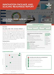
Souss-Massa Online Water Accounting Dashboard: Innovation Package and Scaling Readiness (IPSR) Report
Water availability / Innovation / Decision making / Frameworks / Water accounting
Record No:H053689
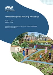
Al Murunah Regional Workshop proceedings. Proceedings of the Al Murunah (Building Climate Resilience through Enhanced Water Security in MENA) Regional Workshop, Amman, Jordan, 4-6 March 2024
The Al Murunah Regional Workshop, held from March 4–6, 2024, at the Geneva Hotel in Amman, Jordan, convened stakeholders and partners involved in advancing resilient nature-based water solutions (RNBWS). Organized by the International Water Management Institute (IWMI), in collaboration with the International Union for Conservation of Nature (IUCN) and country implementation partners (CIP) including the Society for the Protection of Nature in Lebanon (SPNL), Centre for Environment and Development for the Arab Region and Europe (CEDARE) in Egypt, and the Palestinian Hydrology Group (PHG) in the occupied Palestine territories , the workshop served as a pivotal moment in advancing collaborative efforts toward sustainable water management practices in the region.
The objectives of the workshop were multifaceted. They aimed to update partners and stakeholders on project progress, foster a common understanding of RNBWS characteristics, solicit key themes for knowledge exchange, plan for the upcoming Fiscal Year 3 (FY3) activities, and articulate objectives for longer-term peer learning and project outputs from the pilots. Participants included representatives from governmental bodies, non-governmental organizations, private sector entities, international agencies, and project teams from the involved countries.
Throughout the three-day event, engaging sessions and interactive discussions were conducted, covering topics such as national progress updates, pilot programs, FY3 activities, and thematic areas related to RNBWS implementation. Notably, participants emphasized the importance of hybrid nature-based solutions (NBS) tailored to community needs, documented processes to facilitate replication, institutionalization for systemic change, proactive upscaling strategies, and holistic approaches to address labor intensity and ecosystem dynamics.
A key highlight of the workshop was the convergence of project teams and national stakeholders, fostering a collaborative environment rooted in inclusivity and equity. The shared enthusiasm for pilot implementation, peer learning, and gender transformation components underscored a collective vision for sustainable water management practices. Importantly, the workshop facilitated the development of a shared understanding of RNBWS among participants, providing a solid foundation for future endeavors.
Gender / Knowledge sharing / Partnerships / Stakeholders / Policies / Institutions / Climate resilience / Climate change / Water security / Nature-based solutions
Record No:H053687

