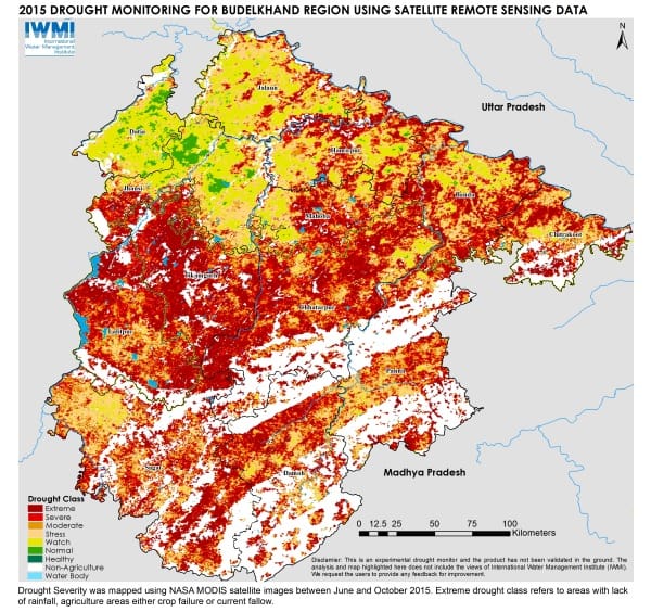
(NEW DELHI. 17 December 2015) The severe drought in Bundelkhand is likely to become a more regular occurrence according to scientists at the International Water Management Institute (IWMI). Records show that the area, straddling the states of Uttar Pradesh and Madhya Pradesh near Jhansi, experienced seven droughts in the last decade. This compares with a drought every decade or so in the 1900s.
The current water scarcity, the most severe this century, has parched an area the size of Mizoram State. Reviewing satellite imagery from earlier in the year, the research team has established that the likelihood of drought was emerging as early as June this year, when abnormally low rainfall patterns became evident. Space based technologies, often referred to as remote sensing, should be more widely used in drought prediction, say the IWMI experts, as they can identify potential problems well before the extent of the conditions on the ground are evident.
“Looking at the aerial images you get a sense of the enormity of what is going on,” said Amarnath Giriraj who leads IWMI’s drought mapping project. “You can clearly see that paddy fields are bone dry and that much farmland is left fallow due to lack of water. But we hope that in future we can use remote sensing to pick up drought trends before there are serious water shortages on the ground so that relief efforts can be more timely.”
Read the full media release


