Vital support for the emergency disaster response in Northeast India and Nepal
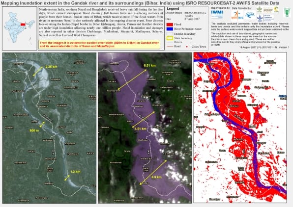
using satellite data from the Indian Space Research Organisation.
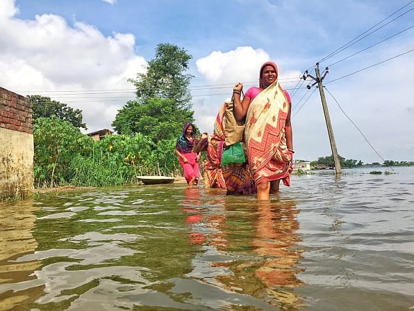
A grainy video shows panic-stricken goats being pulled to safety from flood waters in the middle of the night. It offers a glimpse from social media of efforts in Northeast India to cope with flooding and its consequences for people and their livestock. Incessant rains have given rise during recent days to severe flooding in the Indian states of Bihar and Assam as well as in southern Nepal. An estimated 2 million people have been affected, with dozens dead as a result of flooding and landslides and hundreds of thousands displaced from their homes.
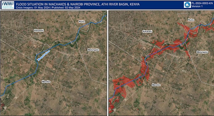
As local disaster management authorities rush to respond, researchers at the International Water Management Institute (IWMI) are providing valuable support in the form of rapid-response maps, based on high-resolution satellite images. These help guide relief efforts by better enabling state and district officials to pinpoint vulnerable populations and get an early indication of damage to crops. Satellite images of flooding along the Gandak River in Saran and Muzaffarpur Districts, for example (see above), show severe damage to crops in most fields.
The Indian Space Research Organisation (ISRO) is the primary source of such images for the entire country, explains Giriraj Amarnath, who leads IWMI’s research group dealing with water-related risks. “The detailed images we provide usefully complement those available from ISRO. We have sent them in response to requests for assistance from partner organizations in Bihar, where we have a project on index-based flooding insurance.”
In addition to sending images directly to partners, Giriraj makes them available on Google Drive, and he recently set up a WhatsApp group for targetted information sharing with about 50 contacts. He is using his personal Facebook page for this purpose as well. One Facebook friend described the images as “very vivid and helpful,” adding: “I am sure our colleagues in Bihar will make full use of these satellite observations in closely monitoring and assessing the extent of areas affected along with the overall impact of the unprecedented floods.”
IWMI researchers based in Delhi and Kathmandu, Nepal, are also actively sharing the information with end-users in these countries and will glean feedback from them to provide a basis for more customized data and information products. Collectively, these efforts form part of two CGIAR Research Programs: Water, Land and Ecosystems (WLE), which IWMI leads, and Climate Change, Agriculture and Food Security (CCAFS), both supported by the CGIAR Fund. Japan’s Ministry of Agriculture, Forestry and Fisheries (MAFF) supports the disaster response work as well.
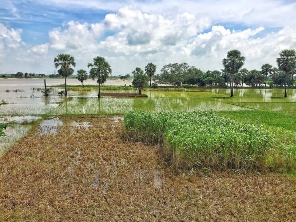
As reported in a recent blog post on the website of Geospatial World magazine, IWMI researchers are using images from the European Space Agency’s Sentinel-1 satellites as well as from the PALSAR-2 sensor of the ALOS-2 satellite of the Japan Aerospace Exploration Agency (JAXA). These sensors have the advantage of being able to “see through” cloud cover, providing a clear overview of areas affected by flooding, with a spatial resolution of less than 10 meters.
IWMI is also using data from ISRO’s RESOURCESAT-2 satellite with the Advanced Wide Field Sensor (AWIFS) and the Landsat 8 Operational Land Imager (OLI) of the United States Geological Survey (USGS). Data from these sources enable us to provide periodic updates on flood disasters at the district to block levels, indicating the vulnerability of local populations and damage to agriculture in considerable detail.
In addition to providing a steady stream of emergency maps, IWMI researchers will soon join representatives of state agriculture and disaster management agencies together with colleagues from the Indian Council of Agricultural Research (ICAR) on a field visit to flood-affected districts of Bihar.


