By Zolo Kiala, Karthikeyan Matheswaran, Chris Dickens, Mariangel Garcia Andarcia, Fulco Ludwig

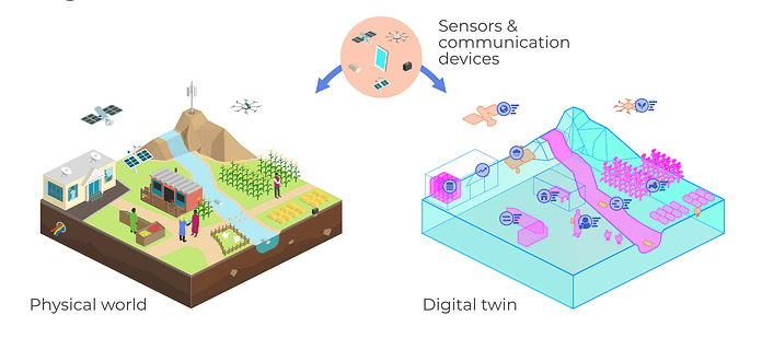
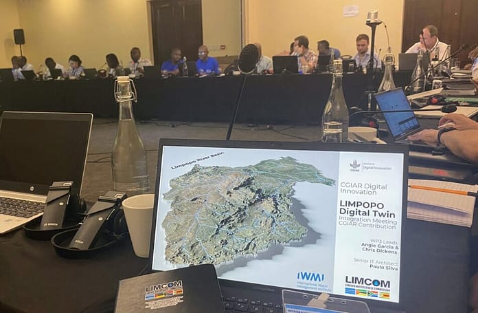
The Limpopo River Basin, spanning four countries in southern Africa, at times faces extreme water scarcity. For communities that rely on agriculture in the basin, the efficient use of water is essential. One of our key projects involves developing a Digital Twin (DT) of the Limpopo River Basin to support better decision-making for managing water in the region.
A crucial component of this project is tracking irrigated areas using publicly available satellite data to understand in near real-time where water is being used, how much is being used, and how these patterns change over time. Irrigation is the lifeblood of agriculture in the Limpopo River Basin, a region where rainfall is inconsistent and often insufficient. Tracking of irrigated areas and their water use within the region can directly inform water management policies and improve irrigation efficiency, ensuring that water is allocated where it’s needed most.
Our irrigation mapping project utilizes machine learning techniques to create monthly maps of irrigated areas with a high spatial resolution of 10 m, covering a basin area of 400,000 square kilometers. The irrigated area maps produced in June and July 2024 revealed that irrigated area acreage was 172,028 ha and 200,000 ha, respectively. These findings show that irrigated area can be monitored at a fine scale and temporal resolution using earth observation data, enabling more accurate and efficient water management within the basin. The figure below shows one of the irrigated area maps for June 2024, illustrating the spatial distribution of irrigation within the basin. However, as with any mapping and modeling effort, the crucial question is how accurately does this map reflect reality? To address this, we initiated a field data collection campaign to validate produced maps and gain deeper insights into the irrigation systems on the ground.

Fieldwork: Gathering ground truth data
Between September 30 and October 5, 2024, the IWMI team traveled to the Limpopo Basin to collect field data so that they can use those data to verify the accuracy of the monthly irrigation maps. We leveraged the survey points from a 2015 IWMI Irrigated Area mapping data collection as a basis for this fieldwork. A detailed survey questionnaire was developed in KoboToolbox, an open-source data collection platform in digital format.
Our primary goal was to record the locations of irrigation systems and related information, such as the types of irrigation systems in use, the crops being grown, and the water sources farmers rely on. With this information, we can compare what we observed in the field with our satellite data.

What we discovered in the field
When the produce is ready for harvest, I sell them to Boxer and Spar.
a farmer who practices canal irrigation
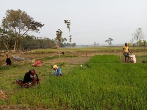
We collected irrigation data from 120 agricultural plots and interviewed 10 farmers. During our visit, we found that commercial farmers who manage large tracts of land predominantly employ center-pivot systems, while smallholders use drip irrigation systems. Additionally, we observed other irrigation methods, such as sprinklers, canal systems, and pipe irrigation in a few farms. The types of crops being irrigated varied across farms. The most common crops we encountered were maize, potatoes, tomatoes, citrus trees, avocado trees, lucerne, and cabbage. Most of these crops were in the growing or seeding stages during our visit. Interestingly, groundwater emerged as the main source of irrigation water among the surveyed farmers. Some visited fields can be viewed in our virtual tour.
In the garden, we normally use our hands to plow from scratch as we do not have machines to do so.
a farmer practices drip irrigation

Challenges and lessons learned
One of the biggest obstacles we encountered was gaining access to the farms. We also found many abandoned smallholder farms where there were fields, surveyed as irrigated in 2015, which are no longer in use. This abandonment of land underscores some of the broader challenges facing smallholder farmers in the region. Identifying specific causes needs further data collection.
The field visit provided valuable insights into the types of irrigation systems used in the basin, the crops grown, and the water sources farmers rely on. Meeting and speaking with farmers gave us a firsthand understanding of their practices and difficulties in managing water in such a dry region.
Bridging the gap: From models to reality

The data we collected during this field visit will be crucial in validating the maps produced by our irrigation mapping framework. By comparing the ground truthed data with irrigated extent from satellite data, we will assess how accurately the monthly irrigated area maps reflect actual conditions on the ground. This feedback loop—using field data to improve model accuracy—is essential for decision-makers to trust the irrigated area mapping data products available as a part of the DT.
Stay tuned for more updates as we continue bridging the gap between satellite data driven irrigated area maps and on-the-ground realities in Limpopo’s irrigated zones.


